Tuesday, December 06, 2011

Joe Puryear Image Sales to Benefit the Access Fund

On October 27, 2010, Joe Puryear died while climbing in Tibet. Just before he departed for his last adventure, Joe set up the joepuryearimages.com website to feature his photography and make it available for others to purchase and enjoy. 

These images are stunning and capture Joe's vision of the world. His enthusiasm and love for exploration are present in each photo and hopefully will inspire others to love and protect these open spaces. 

I will be maintaining and updating this site with Joe's complete history of photos. This will be a work in progress. Forty percent of the proceeds from the sale of his photos will be donated to the Access Fund, an organization Joe deeply believed in. 

Please feel free to contact me if you have any questions or would like to see photos from a blog post that are not yet on the website. 

Thank you, 

Michelle Puryear

Tuesday, May 05, 2009

Old Trip Reports Coming

Check back here as I try to fill in 15+ years of climbing in the Alaska Range...
Thanks! Joe

Wednesday, April 12, 2006

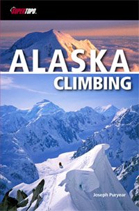
Alaska Climbing Guidebook


Alaska Climbing: The Definitive Guidebook to the Central Alaska Range.
by Joseph Puryear
Praise for Alaska Climbing:
"If the Alaska Range is on your list, this is your guide! Puryear's vast experience backed with SuperTopo lead the way."
- Mike Gauthier, Author, Mount Rainier, a climbing guide
"Don't leave home without it! Joe pulled together the legendary classic routes and put them all in one easy to read book. It's my new tick list for the Alaska Range.”
-Jared Ogden, Top Alpinist
“Rarely do guidebooks offer such extensive first-hand knowledge. Joe’s expertise clearly shows in the detailed route descriptions, photos and topos as well as the general information and strategies for climbing in North America’s alpine mecca.”
-Kelly Cordes, Senior Editor, American Alpine Journal
"The SuperTopo guidebook you are holding will motivate you and help select a climb. Use it as a tool to inspire and plan... May the following pages allow you to unleash your inner quest for adventure."
-from the foreword by Conrad Anker
Whether looking to climb Denali’s West Buttress or scale a wall in the Ruth Gorge, Alaska Climbing is the book to take you there. Author Joseph Puryear’s result of 15 years of Alaska Range climbing and research is the most detailed information ever for the region’s best climbs. Included are routes for all abilities from moderate snow climbs to the difficult testpieces of the range. Each climb gets detailed photo-diagrams, in-depth strategy, camping info, retreat beta, and first ascent history. Detailed color topos and maps bring these climbs to life.
● Complete route profiles for 30 mega-classic snow, ice, mixed, and rock climbs
● First ever published topos for many climbs including Mt. Foraker’s Infinite Spur, Mt. Huntington’s Harvard Route, and Peak 11,300
● Inside knowledge on how to travel in Alaska, where to stay, and what to bring
● Critical information on how to stay alive in the Alaska Range
● Over 150 recent color photos from the area’s top mountaineering photographers
● Suggestions for other area climbs and proposals for new climbs
Check my website for purchasing info and to get a personally signed copy contact me.

Also check out SuperTopo for a bunch for info about the book and Alaska:
www.supertopo.com

Monday, August 01, 2005

First Ascent - Kichatna Spire, The Black Crystal Arête

Chad Kellogg and I spent a few weeks in the remote Kichatna Mountains of the Alaska Range. We managed to climb Kichatna Spire by a new route. This was the eighth ascent of the mountain by its seventh route to the summit. The Black Crystal Arête is the first route to tackle the peak’s southern aspect by climbing the slender ridge that splits its south and east faces.

Kichatna Spire from the Shadows Glacier:


Aerial view of Kichatna Spire from the south:


Paul Roderick flew us into the Shadows Glacier on the evening of July 6. Immediately upon landing we went for the route but were turned around by rain. On the third day we made a second attempt only to be stopped on pitch four by more rain. After spending 5 hours with our feet in plastic garbage bags we pulled the plug and rappelled back to the ground. A few more days of bad weather came and went as we scouted other route possibilities. Finally a splitter two day weather window arrived and we were off and running. We left in the morning of July 11 and made our way quickly to the base of the spire’s south arête. The first six pitches climbed the east wall of the feature. However, what had been dry rock before, was now drifted in with fresh snowfall from the previous day’s storm. What had been relatively straight forward pitches became quite tedious. Pitch 2 proved to be the first crux. I led a small wet roof, followed by a thin detached flake led to a super mantle-reach. Delicate moves with thin gear above a ledge finally moved into more positive terrain.

Chad following up the east wall:


Once on the ridge proper, a few gendarmes provided interesting route finding. The first major one we climbed in three pitches and were able to traverse around its right side just 50’ from its top.

Climbing along the ridge crest. The Sunshine Glacier is in the distance:


A short downclimb off the backside, led to the “Ore Chasm” – a 5-foot wide cleft that require a wide stem.

The first gendarme. Chad can be seen down climbing toward the “Ore Chasm”:


A few easier pitches led to another gendarme only passable by a rotten chimney on its right side. Chad led up the “Bombay’s Away” pitch – named after a huge booger of rock five times his size that flushed out of the chimney as he climbed up and stood on top of it. Unscathed, he continued aiding and climbing up huge overhanging flakes to the top.

The actual ridge was pretty short lived, however, as it completely dead-ended into the upper south face. The only way to continue seemed to be a set of horizontal twin seems that led out left. Gaining instant 2,000+-foot exposure, Chad led across the thin traverse to the base of another nasty looking chimney.

Chad leading the key horizontal traverse high on the route:


I got the next pitch – a vertical ice-smeared chimney we dubbed “Icebox Desperado”. It might have been a brilliant M6 pitch had we had crampons and ice-tools. But with only rock shoes it proved to be an interesting mix of aid and free up disintegrating ice filled cracks.

This gave way to slightly easier terrain and after a few more pitches we crested the summit ridge, just 200 horizontal feet from the true summit. We topped out on a beautiful, albeit smoky, evening, as we watched the sun make its long descent towards Mt. Foraker.

On the summit looking northwest:


A view to the west. Middle Triple peak is on the left:


We sat on the warm and windless summit for about 45 minutes, before starting the long and dreaded descent.

The 2nd rappel:


We rappelled throughout the night. The crux was having to repeat a few of the key traverses with frozen fingers and toes.

Repeating the key traverse just after midnight:


About 20 rappels later, we returned to the Shadows glacier just in time for the sun to warm us up again. A short stroll back to camp and we were back just 25 and half hours after starting. We named our route after the most amazing black rock crystals we found on the summit ridge, some of which were upwards of 2 feet long!

The next 10 days or so we spent attempting the Citadel. We spent a week in a portaledge on the peak’s east face, but were thwarted by weather and bad rock. We also made another single-push attempt on its unclimbed south ridge, but we fell short of the summit by about 800-feet (that might be considered a new route by some people. ha!)

We knew our time on the glacier was drawing to an end with the rapid recession of the fern line toward our landing spot. Soon we would be camped on top of ice and after another week, we may not have been able to be picked up. So we packed it up, dialed Paul on the Sat phone and headed home.

Wednesday, June 30, 2004

The Cobra Pillar - first one day - speed ascent, Mt. Barrill, Alaska Range

In mid-June, Chris McNamara and I traveled to the Ruth Gorge in the Alaska Range. Our first objective was the 2,700-foot Cobra Pillar on Mt. Barrill (VI, 5.11, C1, 23 pitches). After much work and many tries, the first ascent of this route was made by Jim Donini and Jack Tackle over 6-days in June of 1991. Two subsequent ascent were made in 3 and 2 days. Our goal was to make the 4th ascent and do it in a single-push, using Yosemite-style speed tactics. Leaving the ground at 3 p.m. on June 13 with one 60-meter rope, a double set of cams, one wall hammer/ice pick each, and no crampons, we made the ascent in 15 hours and 10 minutes, summitting the next morning just after 6 a.m.

The east face of Mt. Barrill, showing the line of the Cobra Pillar:


We climbed the route in 2 blocks, switching leads at around 10:30 p.m. Chris took the first block, which included much of the difficult free-climbing.

Chris leading the 1st pitch off the glacier:


The pendulum traverse on pitch 3:


Chris leading pitch 5, we dubbed this belay the "gravel shower" belay, due to home much loose rock poured down on me:


Pitch 8 leading toward the huge cleft on the left:


The huge cleft:


Chris leading the 10th pitch, which is a dead horizontal 100-foot right traverse to reach the splitter headwall cracks on the huge shield mid-route.


Chris leading the splitter 5.10 finger crack on pitch 12.


It's not as dark as it looks in this picture. I took over the lead here, but didn't need a headlamp (we didn't even bring them) due to the long Alaskan summer days. Unfortunately though, it was too dark to take anymore pictures of my leads till morning.


Chris walking the last slope to the summit. Mt. Dickey behind.


Our descent was difficult and scary. High avalanche danger, no crampons, no real ice-tools, no snow-travel gear, we descended this slope (the northwest face) with a bit of luck and post-holed back around to our camp in the Ruth Gorge, returning to camp about 20 hours after we left.


A final look at Barrill with a lenticular cloud over Denali in the distance.

First Ascent - Goldfinger, The Stump, Ruth Gorge, Alaska Range

After climbing The Cobra Pillar, The Southwest Face of Hut Tower, and the West Pillar of the Eye Tooth, Chris and I were ready to get on a new route. We found that the rock in the basin of the Eye Tooth, Wisdom Tooth, and the Stump was exceptionally good. After two tries we put together the route Goldfinger (IV, 5.11, 12 pitches), which takes a direct line up the left of two major dihedrals splitting the face. The climb was challenging and sustained with splitter cracks and good protection.

An overview of the south face of the Mooses Tooth massif, with the route Goldfinger on the Stump marked:


Looking up the route from the base:


We swapped leads the whole way - each pitch was close to a full 60 meters.
Chris leading on the initial dihedral:


Joe leading another dihedral pitch:


Splitter cracks everywhere...


The crux of the route came on the 9th pitch. A very thin finger crack led to a dyno to an off-width, then an airy traverse left to a horizontal roof crack. Chris cruised the pitch onsight!


Chris on top of the Stump:


Chirs, with Mt. Barrill and Denali in the background.


We made 12 long rappels down the route and installed good anchors so the route could one day be repeated and become classic.